


Voting District 030003, Franklin County, New York
About
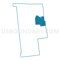
Outline

Summary
| Unique Area Identifier | 627207 |
| Name | Voting District 030003 |
| County | Franklin County |
| State | New York |
| Area (square miles) | 107.26 |
| Land Area (square miles) | 105.32 |
| Water Area (square miles) | 1.94 |
| % of Land Area | 98.19 |
| % of Water Area | 1.81 |
| Latitude of the Internal Point | 44.71087950 |
| Longtitude of the Internal Point | -74.09820500 |
Maps


Graphs
Select a template below for downloading or customizing gragh for Voting District 030003, Franklin County, New York


Neighbors
Neighoring Voting District (by Name) Neighboring Voting District on the Map
- Voting District 030001, Franklin County, NY
- Voting District 030002, Franklin County, NY
- Voting District 080002 080003, Clinton County, NY
- Voting District 090003, Clinton County, NY
- Voting District 110001, Franklin County, NY
- Voting District 130001 130002, Franklin County, NY
- Voting District 140003, Clinton County, NY
- Voting District 150001, Franklin County, NY
- Voting District 150004, Franklin County, NY
Top 10 Neighboring County Subdivision (by Population) Neighboring County Subdivision on the Map
- Malone town, Franklin County, NY (14,545)
- Dannemora town, Clinton County, NY (4,898)
- Saranac town, Clinton County, NY (4,007)
- Ellenburg town, Clinton County, NY (1,743)
- Bellmont town, Franklin County, NY (1,434)
- Franklin town, Franklin County, NY (1,140)
- Duane town, Franklin County, NY (174)
Top 10 Neighboring Unified School District (by Population) Neighboring Unified School District on the Map
- Malone Central School District, NY (19,958)
- Saranac Lake Central School District, NY (13,583)
- Saranac Central School District, NY (13,043)
- Northern Adirondack Central School District, NY (6,570)
- Chateaugay Central School District, NY (3,568)
Top 10 Neighboring State Legislative District Lower Chamber (by Population) Neighboring State Legislative District Lower Chamber on the Map
Top 10 Neighboring State Legislative District Upper Chamber (by Population) Neighboring State Legislative District Upper Chamber on the Map
Top 10 Neighboring 111th Congressional District (by Population) Neighboring 111th Congressional District on the Map
Top 10 Neighboring Census Tract (by Population) Neighboring Census Tract on the Map
- Census Tract 1004, Clinton County, NY (7,378)
- Census Tract 1018, Clinton County, NY (5,504)
- Census Tract 9504, Franklin County, NY (5,043)
- Census Tract 9508, Franklin County, NY (2,575)
- Census Tract 9506, Franklin County, NY (1,608)
Top 10 Neighboring 5-Digit ZIP Code Tabulation Area (by Population) Neighboring 5-Digit ZIP Code Tabulation Area on the Map
- 12953, NY (15,836)
- 12920, NY (2,842)
- 12981, NY (2,253)
- 12989, NY (1,010)
- 12952, NY (546)
- 12969, NY (423)
- 12955, NY (381)